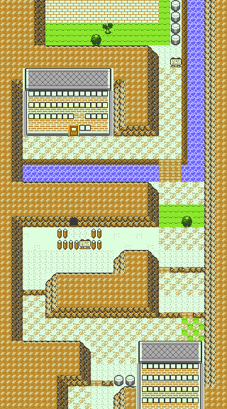
Development:Pokémon Gold and Silver/Unused Maps/Routes
This is a sub-page of Development:Pokémon Gold and Silver/Unused Maps.
Johto
Route 29
| DMYMAP (October 6th, 1998) |

|
|---|---|
| Final (August 1st, 1999) |

|
The first Route! It starts a trend that most of the early Johto routes have: very linear, and very rarely any points where you need to step into tall grass to progress. The designers also make some weird patterns with the Headbutt trees on many of them. The early version's file name is ROAD129.FLD, and the final is ROAD129.MAP.
| Earlier (October 13th, 1998) |

|
|---|---|
| Later (October 14th, 1998) |

|
There are also these intermediate maps. These ones still seem to have the concept of the Silent Hills dungeon on the first Route as seen in the Spaceworld '97 demo. Interestingly, the earlier map has more tall grass than the later one. The earlier one is the backup version of Route 29, as ROAD129.FLD, and the later one is in the MAPDATA folder as ROAD129B.MAP.
Route 30
| DMYMAP (October 6th, 1998) | Final (July 18th, 1999) |
|---|---|

|

|
And so continues the trend. Nothing really interesting aside from the river, just a straight line. Mr. Pokémon's house isn't on this Route in the DMYMAP version. The early version's file name is ROAD130.FLD, and the final is ROAD130.MAP.
Route 31
| DMYMAP (October 6th, 1998) |

|
|---|---|
| Final (July 18th, 1999) |
|
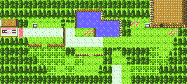
And here's where Mr. Pokémon's house (presumably) is in the DMYMAP version. Otherwise, just a 90-degree turn and a straight line. The early version's file name is ROAD131.FLD, and the final is ROAD131.MAP.
Route 32
| DMYMAP (October 6th, 1998) | Final (July 9th, 1999) |
|---|---|

|

|
There's a whole lot more water here. The Ruins of Alph and Union Cave are seemingly missing.
Route 33
| DMYMAP (October 6th, 1998) | Final (July 6th, 1999) |
|---|---|

|
|
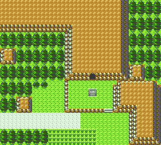
Instead of connecting Route 32 to Azalea Town, the DMYMAP version of Route 33 connects the unused town in the final game to Azalea Town. The early version's file name is ROAD133.FLD, and the final is ROAD133.MAP.
There is also another version that contains a dungeon between the two towns. This can be found in many places. In the backup version, it is ROAD133.FLD, and can be found in the MAPDATA folder as ROAD133B.MAP and HILLCEL.MAP. It was last modified October 13th, 1998.
Route 34
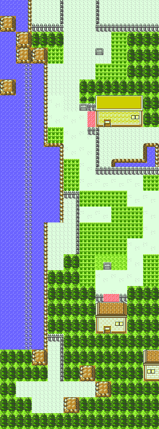
| DMYMAP (October 6th, 1998) | Final (July 13th, 1999) |
|---|---|
|
|
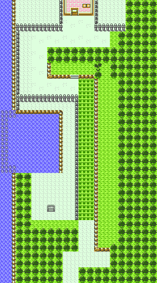
Amazingly enough, this Route actually requires you to step in some tall grass! The Day Care and Cooltrainer secret hideout are not present yet. The early version's file name is ROAD134.FLD, and the final is ROAD134.MAP.
Route 35
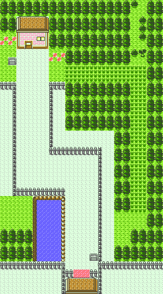
| DMYMAP (October 6th, 1998) | Final (July 9th, 1999) |
|---|---|

|
|
DMYMAP Route 35 revolutionizes the straight line design of Routes by slightly winding a bit. The only things worth noting are the lack of the National Park entrance and the missing exit carpet from the Goldenrod gate. The early version's file name is ROAD135.FLD, and the final is ROAD135.MAP.
Route 36
| DMYMAP October 6th, 1998) |

|
|---|---|
| Final (July 9th, 1999) |

|
A strangely symmetrical lake connects Goldenrod City to Ecruteak and Violet City. The early version's file name is ROAD136.FLD, and the final is ROAD136.MAP.
Route 37
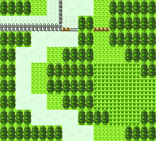
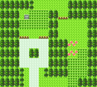
| DMYMAP (October 6th, 1998) | Final (August 23rd, 1999) |
|---|---|
|
|
Compared to the Routes so far, Route 37 is closer to the final than any of them. The early version's file name is ROAD137.FLD, and the final is ROAD137.MAP.
Route 38
| DMYMAP (October 6th, 1998) |
|
|---|---|
| Final (July 9th, 1999) |

|
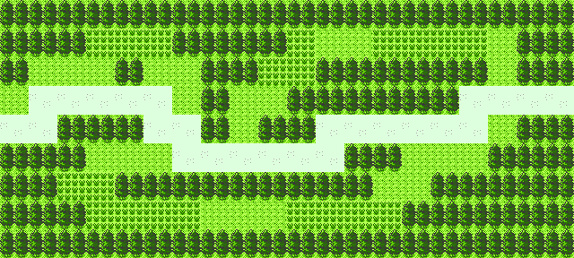
The three-path layout of the final Route is in place, but there's little to no reason to not stick to the middle path. The gate to Ecruteak City is missing. The early version's file name is ROAD138.FLD, and the final is ROAD138.MAP.
Route 39
| DMYMAP (October 6th, 1998) | Final (August 26th, 1999) |
|---|---|

|
|
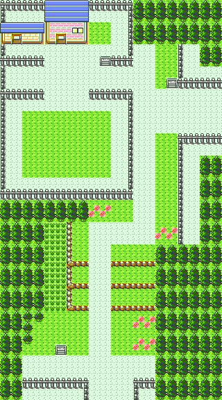
The farm space is drastically smaller, the barn is a separate building instead of being right next to the farmhouse, and there's a pond that was removed in the final map. The early version's file name is ROAD139.FLD, and the final is ROAD139.MAP.
Route 40
| DMYMAP (October 6th, 1998) | Final (July 8th, 1999) |
|---|---|

|
|
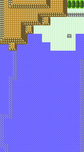
Route 40 connects directly south to Olivine City, so no space in the DMYMAP version is used for the beach. The early version's file name is ROAD140.FLD, and the final is ROAD140.MAP.
Route 41
| DMYMAP (October 6th, 1998) | Final (June 4th, 1999) |
|---|---|

|
|
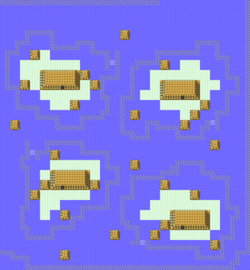
Instead of connecting to Cianwood City, Route 41 connects back to Goldenrod City. The Whirl Islands are nowhere to be seen. The early version's file name is ROAD141.FLD, and the final is ROAD141.MAP.
Route 42
| DMYMAP (October 6th, 1998) |

|
|---|---|
| Final (June 9th, 1999) |

|
Route 42 is another straight line, and doesn't have Mt. Mortar or any bodies of water to vary things up at all. The early version's file name is ROAD142.FLD, and the final is ROAD142.MAP.
Route 43
| DMYMAP (October 6th, 1998) | Final (July 9th, 1999) |
|---|---|
|
|
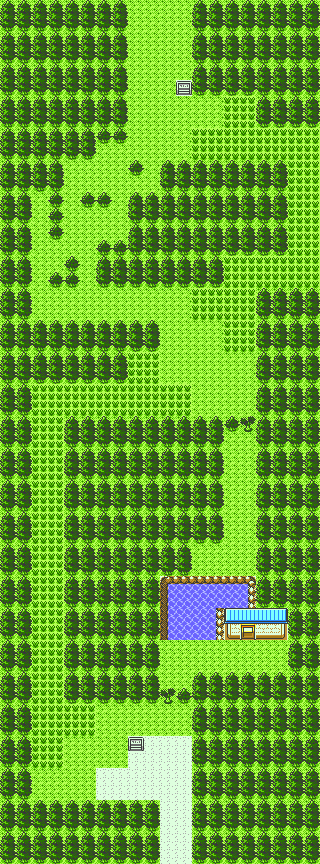
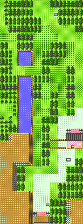
Route 43 is somewhat similar to the final map. The vertical stretches of tall grass were made shorter, and (given that it's missing on the Lake of Rage DMYMAP version) the house might be the house of the Fishing Guru. The early version's file name is ROAD143.FLD, and the final is ROAD143.MAP.
Route 44
| DMYMAP (October 6th, 1998) |

|
|---|---|
| Final (August 10th, 1999) |

|
Layout is more-or-less complete. The final map just has more stuff added around the ponds. The Ice Path is completely missing in the DMYMAP version, however. The early version's file name is ROAD144.FLD, and the final is ROAD144.MAP.
Route 45
| DMYMAP (October 6th, 1998) | Final (August 16th, 1999) |
|---|---|

|

|
Structurally, the layout is identical to the final map. The only difference is the lack of tall grass, dirt, and entrance to Dark Cave. This version of the map also appeared in pre-release screenshots. The early version's file name is ROAD145.FLD, and the final is ROAD145.MAP.
Route 46
| DMYMAP (October 6th, 1998) | Final (July 9th, 1999) |
|---|---|
|

|
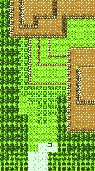
Also largely similar to the final. There are fewer ledges, no entrances to Dark Cave, and there's no gate between it and Route 29. The early version's file name is ROAD146.FLD, and the final is ROAD146.MAP.
Kanto
Route 27
| DMYMAP (October 6th, 1998) |

|
|---|---|
| Final (August 7th, 1999) |

|
The DMYMAP version is interesting, as there's nothing that seems to block the player from going this way at the start, and heading north directly leads to Route 28. Tohjo Falls is missing, and the house of the person who gives the Sandstorm TM is just kind of placed in the middle of the map. The early version's file name is ROAD127.FLD, and the final is ROAD127.MAP.
Route 26
| DMYMAP (October 6th, 1998) | Final (August 20th, 1999) |
|---|---|

|

|
The DMYMAP version lacks the rest house that the final map has. The house seen in this early map would have been a haunted house, a location which was ultimately scrapped, and whose spot on the map was ultimately replaced with the Week Siblings' house. The early version's file name is ROAD126.FLD, and the final is ROAD126.MAP.
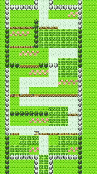
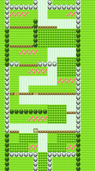
Route 1
| Generation I | DMYMAP (October 6th, 1998) | Final (August 21st, 1999) |
|---|---|---|
|
|
|
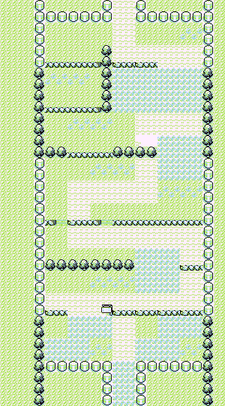
The flowers to the left of the exit to Viridian City were moved from below the ledge to above it. The early version's file name is ROAD1.FLD, and the final is ROAD1.MAP.
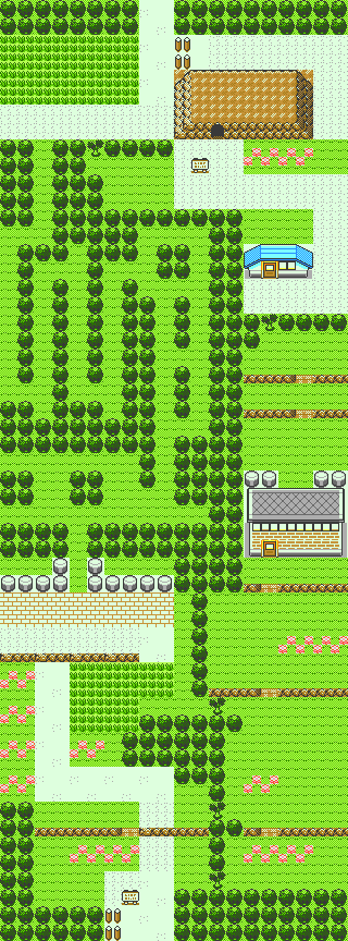
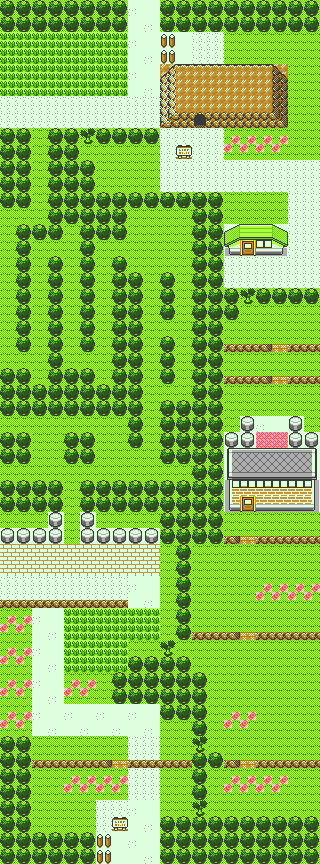
Route 2
| Generation I | DMYMAP (October 6th, 1998) | Final (August 21st, 1999) |
|---|---|---|

|
|
|
The north exit of the side gate is missing the exit carpet. The early version's file name is ROAD2.FLD, and the final is ROAD2.MAP.
Route 3
| Generation I | 
|
|---|---|
| Backup (October 14th, 1998) |

|
| Final (October 15th, 1998) |

|
One hole in the first ledge on the Route was removed. The early version's file name is ROAD3.FLD, and the final is ROAD3.MAP.
Route 4
| Generation I | 
|
|---|---|
| Backup (October 14th, 1998) |

|
| Final (August 29th, 1999) |
|
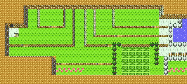
The path that leads to Cerulean Cave in Generation I is still here, as Cerulean Cave is also present. The early version's file name is ROAD4.FLD, and the final is ROAD4.MAP.
ROAD34.MAP is a variant map that combines Routes 3 and 4 into a single map. Both parts of it are similar to the backup versions', but some changes were made, such as the dirt around the Mt. Moon exit sign being removed. It was last modified on October 14th, 1998.
Route 5
| Generation I | DMYMAP (October 6th, 1998) |
|---|---|
|
|
| Backup (October 14th, 1998) | Final (July 30th, 1999) |
|
|
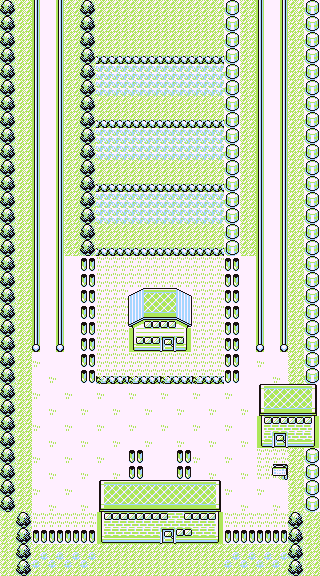
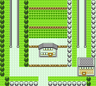
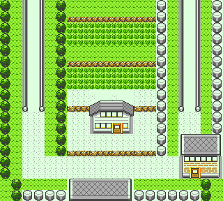
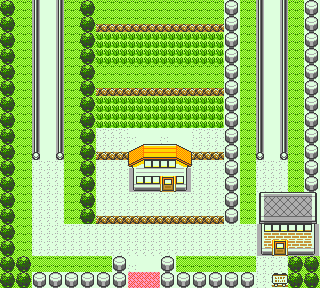
The first of the four Routes connected to Saffron City. In the DMYMAP version, there are no gates between Saffron City and the surrounding Routes. The backup version is closer to the final, but has the roof of the gate on the Route itself, instead of being entirely in the Saffron City map. It is also missing the exit carpet. The early version's file name is ROAD5.FLD, and the final is ROAD5.MAP.
Route 8
| Generation I | 
|
|---|---|
| DMYMAP (October 6th, 1998) |
|
| Backup (October 14th, 1998) |

|
| Final (August 29th, 1999) |
|
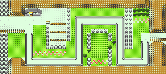
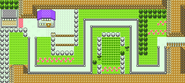
There are more posts on the right side of the Route, and the flowers are arranged differently. This gate is only partially on Route 8 in the backup version, but was moved to be entirely on Route 8 in the final. The early version's file name is ROAD8.FLD, and the final is ROAD8.MAP.
Route 9
| Generation I | 
|
|---|---|
| DMYMAP (October 6th, 1998) |

|
| Backup (October 14th, 1998) |

|
| Final (October 27th, 1998) |

|
Mostly identical to the final. The Pokémon Center only has the roof on Route 9 in the final. Strangely enough, while the DMYMAP versions of most maps have Kanto dungeons that aren't in the final, Rock Tunnel - a dungeon that is in the final - isn't accessible. The early version's file name is ROAD9.FLD, and the final is ROAD9.MAP.
Route 10
| Generation I | Backup (October 14th, 1998) | Final (September 1st, 1999) | |
|---|---|---|---|
| North | 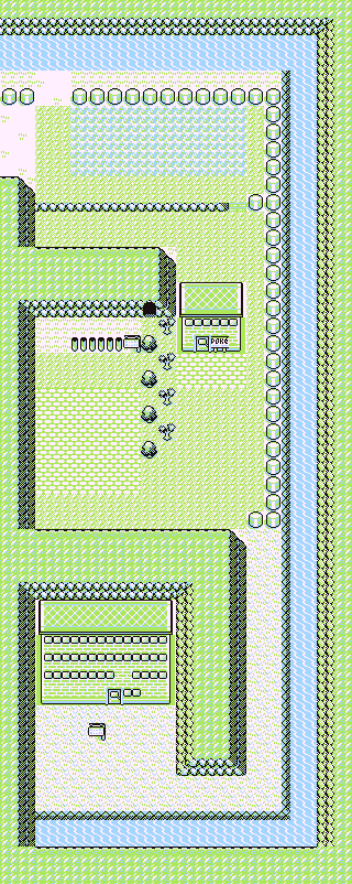
|

|
|
| South | 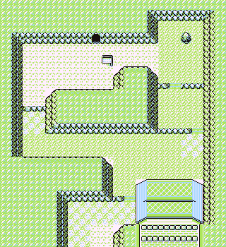
|

|
|
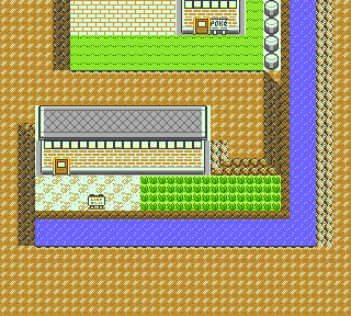
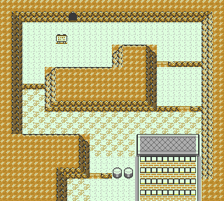
On the north side, the Power Plant is accessible without needing Surf, and the sign for it is in a different position. The shortcut to Lavender was patched back up, but the dock block was left untouched. On the south side, there are some different ground tiles used, and some of the mountain behind Lavender Radio Tower was removed. The north map's file name is ROAD10_1.MAP, and the south map's file name is ROAD10_2.MAP.
A variant of the map exists as ROAD10.MAP, which combines both the north and south sides into one map. The wall between the two sides of Route 10 was removed to accommodate for Rock Tunnel being inaccessible. It was last modified on October 14th, 1998.
Route 11
| Generation I | 
|
|---|---|
| DMYMAP (October 6th, 1998) |
|
| Final (June 22nd, 1999) |

|
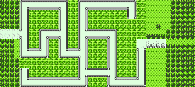
The sign is missing on the west side. The early version's file name is ROAD11.FLD, and the final is ROAD11.MAP.
Route 12
| Generation I | DMYMAP (October 6th, 1998) | Final (July 28th, 1999) |
|---|---|---|

|

|

|
The ground on various points of the bridge was changed to flowers, and there is tall grass at the bottom of the Route as in Gen I. The early version's file name is ROAD12.FLD, and the final is ROAD12.MAP.
Route 13
| Generation I | 
|
|---|---|
| DMYMAP (October 6th, 1998) |

|
| Final (June 23th, 1999) |

|
A sign was removed by the cut tree. The early version's file name is ROAD13.FLD, and the final is ROAD13.MAP.
Route 14
Another rare map that's identical to the final map.
Route 15
| Generation I | 
|
|---|---|
| DMYMAP (October 6th, 1998) |
|
| Backup (October 14th, 1998) |
|
| Final (October 20th, 1998) |
|
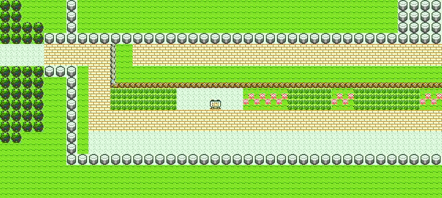
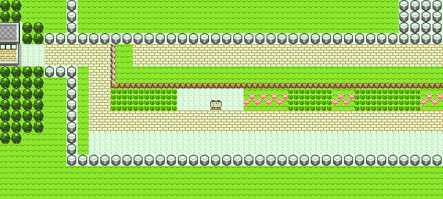
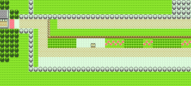
As with Saffron City, the DMYMAP version is completely missing the gate between Fuchsia City and Route 15. The backup version, meanwhile, is only missing the exit carpet for the gate. The early version's file name is ROAD15.FLD, and the final is ROAD15.MAP.
Route 17
| Generation I | DMYMAP (October 6th, 1998) | Final (February 26th, 1999) |
|---|---|---|

|

|

|
For starters, while the Gen I map was entirely covered in flowers, the DMYMAP version is completely devoid of flowers. The final map added some back in. More importantly, the exit gate for Cycling Road is missing. The early version's file name is ROAD17.FLD, and the final is ROAD17.MAP.
Route 19
| Generation I | DMYMAP (October 6th, 1998) |
|---|---|
|
|
| Backup (October 14th, 1998) | Final (July 10th, 1999) |
|

|
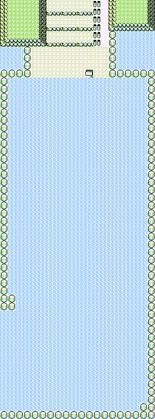
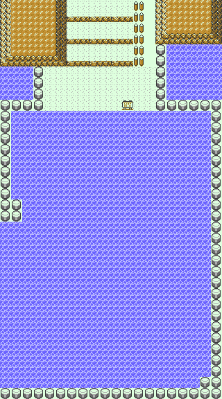
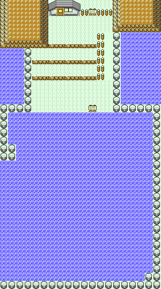
The last major gate in the game. The DMYMAP version has a significantly shorter beach, and while the backup version's is the same size as the final, the ledges are higher up on the beach. The gate also is only a small house. The early version's file name is ROAD19.FLD, and the final is ROAD19.MAP.
Route 20
| Generation I | 
|
|---|---|
| DMYMAP (October 6th, 1998) |

|
| Final (July 10th, 1999) |

|
The DMYMAP version is much closer to the Gen I version, only a bit shorter. The entrance to the other Seafoam Island is still open, which makes sense as Blaine's Gym is still present on Cinnabar Island at this point. The early version's file name is ROAD20.FLD, and the final is ROAD20.MAP.
Route 21
| Generation I | DMYMAP (October 6th, 1998) | Final (June 21st, 1999) |
|---|---|---|

|
|
|
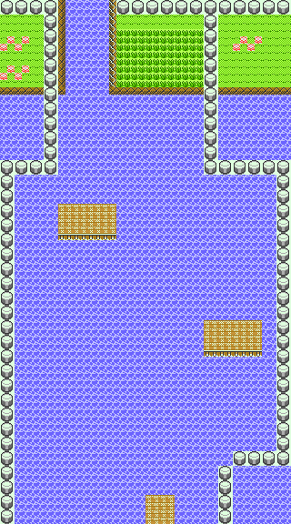
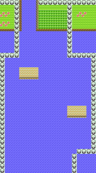
The northern dock on Cinnabar Island is still present in the DMYMAP version, of course, as Cinnabar hasn't erupted in this version of the map. The early version's file name is ROAD21.FLD, and the final is ROAD21.MAP.
Route 22
| Generation I | 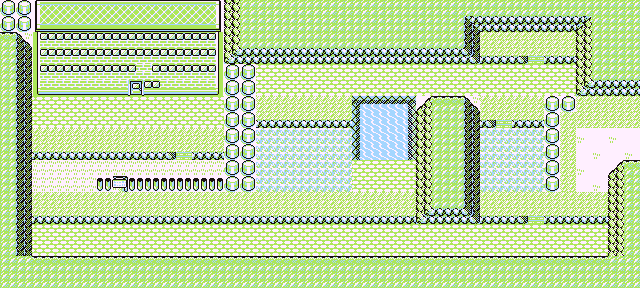
|
|---|---|
| DMYMAP (October 6th, 1998) |
|
| Final (June 2nd, 1999) |
|
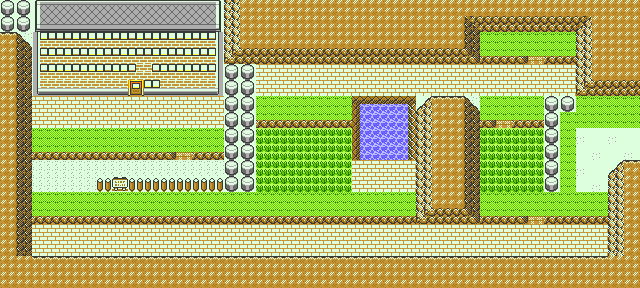
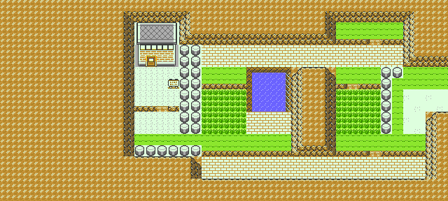
The DMYMAP version is identical to the Gen I map! The early version's file name is ROAD22.FLD, and the final is ROAD22.MAP.
Route 25
| Generation I | 
|
|---|---|
| DMYMAP (October 6th, 1998) |

|
| Final (August 22nd, 1999) |

|
The DMYMAP version combines Routes 24 and 25 into a single map. The ledge in the upper left corner of the map is covered in dirt, as it was in Gen I, instead of grass like the final. The early version's file name is ROAD2425.MAP, and the final is ROAD25.MAP.
Route 28
| DMYMAP (October 6th, 1998) | Final (June 3rd, 1999) |
|---|---|
|
|
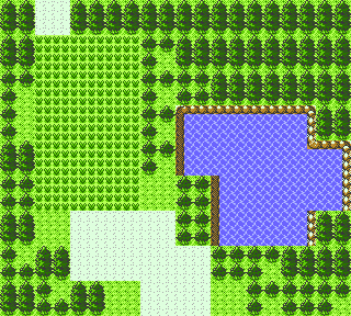
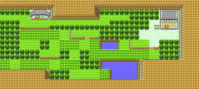
Not only is the celebrity's house missing, but the entire tileset is different. In the DMYMAP version, since it directly connects to Route 27 to the south, it uses the Johto tileset, whereas in the final it uses the Kanto tileset. The early version's file name is ROAD128.FLD, and the final is ROAD128.MAP.


